Defining Body Mapping
The phrase ‘body mapping’ has many interpretations. It appears as nebulous as it is exact, with the user either struggling to communicate their construct or utilizing words so specific that it pigeon-holes the potential meaning into a singular stranded notion — too big to grasp or too miniscule to get a hold of. What remains is a fractive certain sects lay claim to or an ambiguous notion left unidentified, and thus, unwanted.
Shared language being imperative for translation, the words used must be both accessible and universally understood by both sides. The speaker is responsible for meeting the listener where they are. Transference is dependent on the receiver’s ability (and motivation) to accept the offering. How will it benefit them to know this? The value of better understanding themselves and how they operate must be worth the disruption to one’s comfortable and familiar perspective.
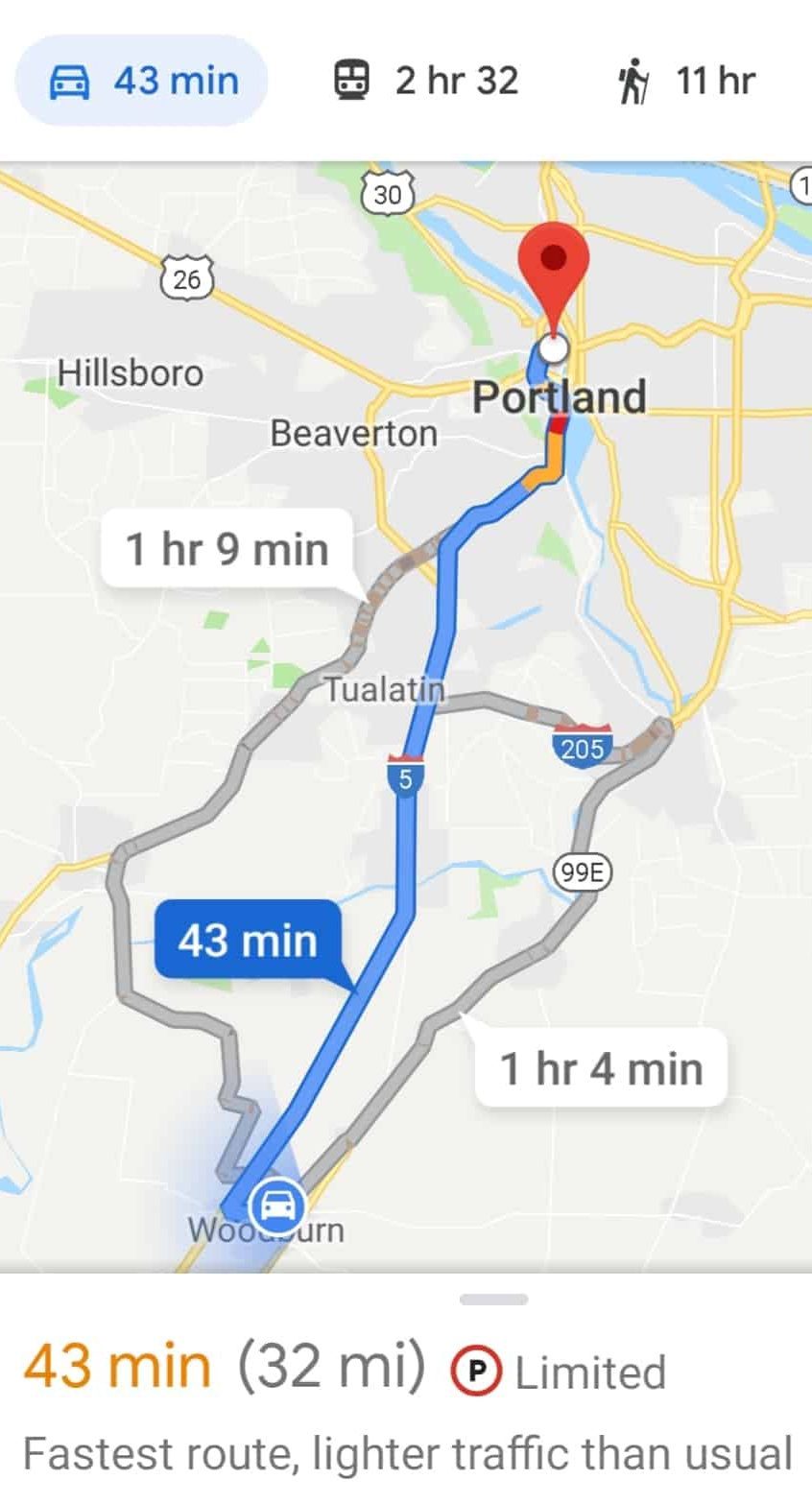
Since the most widely used (to the point of dependency) mapping service is Google maps, it serves as a common known by which to connect to an unknown. It utilizes two points – where you are and where you want to go, and offers several options one might take to get there. The suggested and clearly marked option is based on efficiency, as measured by shortest time (which, interestingly enough, is not always shortest distance).
It lays out the path of least resistance, and indicates which areas get sticky or bottlenecked. Though available in three dimensional viewing, the 2-D format is by far the most popular, cutting out extraneous details that might confuse the users orientation. A zoomed out arial view is preferred over street view, and the breadth of the real-time voice-and-visual guided directions is chunked into digestible bits, only revealing what may come in the next few minutes of a much longer drive.
With the parallels laid out, we can start pulling personal significance from behind the metaphor.
Two Points
This can be your body as a whole or a particular part of it. Where you think you are might not be as accurate as you may believe. The satellites tracking us are not objective. The data we rely on to track ourselves and our position in space is subjective, and is often skewed upon our biases of where we want to be. For a more accurate picture, note yourself at rest. It’s where we spend the most time, and how we are when not trying to do or be or achieve.
Path of Least Resistance
How two points relate to one another depends on the variability of their interaction. The frequency of interaction accumulates as favorites or recents. How often do you type in a new search? Which routes are automatically engrained? When an unplanned or unforeseen event clogs the highway we rely on, do we sit in frustration or adjust, trying to find another way?
Pain is the red areas outlined in yellow. Use caution. Don’t go there. Go around. Avoid. Roads closed, we either go out less or flood the side streets that were not made for dense traffic. On foot gives us the most options, but since it is less convenient and takes more time and effort, it’s hard to consider it might be the most enjoyable.
2-D or 3-D
When we don’t want to know the place we are moving through, we trust in the validity of a flat blue line. Getting to our destination is our primary goal, and we seek routes that are clearly marked and designated. The only additional points of interest we consider are those listed along the way. Three-dimensional provides a more robust experience, but it also asks that we pause and notice the layers and multiple angles and contexts within of our frame of reference.
We do not pull off onto viewpoints that we’ve seen before or are too similar to what we already recognize. Few want to linger and rediscover. They want more and novel, and because of the lack of depth of their explorations, more appears new and exciting though it’s actually the same. Additional inputs require simplistic calibrating to keep expanding under finite processing resources. Drawing a line is much easier than explaining where to drag the pen (and why).
Big Picture Aerial View
Remove the given highlighted pathway and a map is simply a snapshot of the landscape. A picture of clover fields gives you no information about where it is located, nor where it is relative to where you are. Names and towns are needed in order to zero in and affix an address. The direction to take is always oriented forward and according to traffic rules. We abide by a systemic way of navigating even if we’re unaware of it. Less options influence the flow of the masses. Individual attentions determine what is notable and then actively pursue additional focused [re]search. The street view function only confirms the destination – a culmination of following and intent.
Digestible Bits
To follow, one needs sequence. They need one through four without the intrusion of fourteen. Speed is a by-product of understanding. By looking to far ahead, you miss what’s right in front of you.
Body mapping, in its most straight-forward sense, is how one gets from here to there. It is an awareness and assimilation of the internal and the means in which it interacts with the external environment.
How much is known versus just guessing? Can both the process and the product be repeated? How well do you know the lay of the land to take your own detour? How much do you trust the vehicle of your body to venture into uncharted territory?
Maps are impermanent fixtures. They change as information allows. What you don’t know will always be an infinite expanse compared to what you do know. The ability to learn, notice, and adapt makes repeated paths freshly enjoyable, and unusual treks a desired adventure.


